de Wit, Frederick
CIMBEBAS ET CAFFARIAE LITTORA A CATENBELA AND PROMONTORUM BONAE SPEI. Amsterdam, 1680 first edition
LOT 450
de Wit, Frederick
CIMBEBAS ET CAFFARIAE LITTORA A CATENBELA AND PROMONTORUM BONAE SPEI. Amsterdam, 1680 first edition
Lot Estimate Change Currency
ZAR 4 000 - 6 000
Selling Price
Incl. Buyer's Premium & VAT
Incl. Buyer's Premium & VAT
ZAR 5 270
About this Item
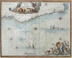
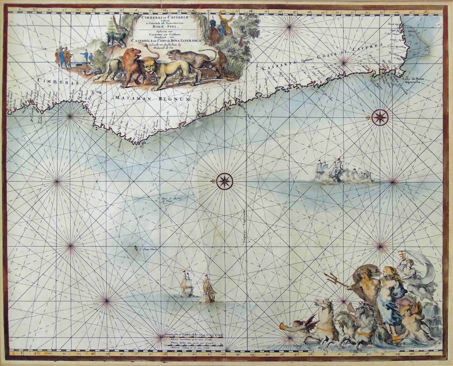
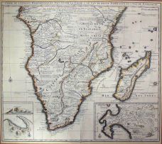
de Wit, Frederick
CIMBEBAS ET CAFFARIAE LITTORA A CATENBELA AND PROMONTORUM BONAE SPEI. Amsterdam, 1680 first edition
The hand coloured Marine chart has a large title piece with lions, native tribesmen and European traders. Contains a cartouche of Neptune at the bottom. Depicting the coast from Luanda to the Cape of Good Hope to Fish Bay.
Guide to Maps of Africa, p. 124 and plate 95
44,5 by 55cm excluding frame; 70,5 by 80,5 by 2cm including frame
More from South African and International Fine and Decorative Art

Die Groet van Vêr
ZAR 500 - 700

ZAR 10 000 - 15 000

Tribute to Deborah Bell
ZAR 8 000 - 12 000
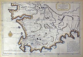
After Kolben, Peter
A MAP OF THE COUNTRY OF THE HOTTENTOTS, TOWARDS THE CAPE OF GOOD HOPE. Netherlands, circa 1750 first edition
ZAR 1 000 - 1 500
Bowen, Emanuel
A NEW & ACCURATE MAP OF THE SOUTHERN PARTS OF AFRICA, CONTAINING LOWER GUINEA, MONOEMUGI, ZANGUEBAR, AND EMPIRE OF MONOMOTAPA, COUNTY OF THE CAFRES &C. AND THE ISLD. OF MADAGASCAR. London, 1747 first edition
ZAR 2 000 - 3 000
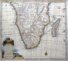
Nicolas Janz Visscher II
CARTE DE L'AFRIQUE MERIDIONALE. Amsterdam, 1730 first edition
ZAR 4 000 - 6 000