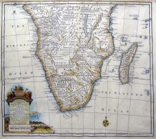
After Kolben, Peter
A MAP OF THE COUNTRY OF THE HOTTENTOTS, TOWARDS THE CAPE OF GOOD HOPE. Netherlands, circa 1750 first edition
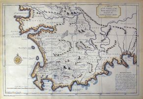
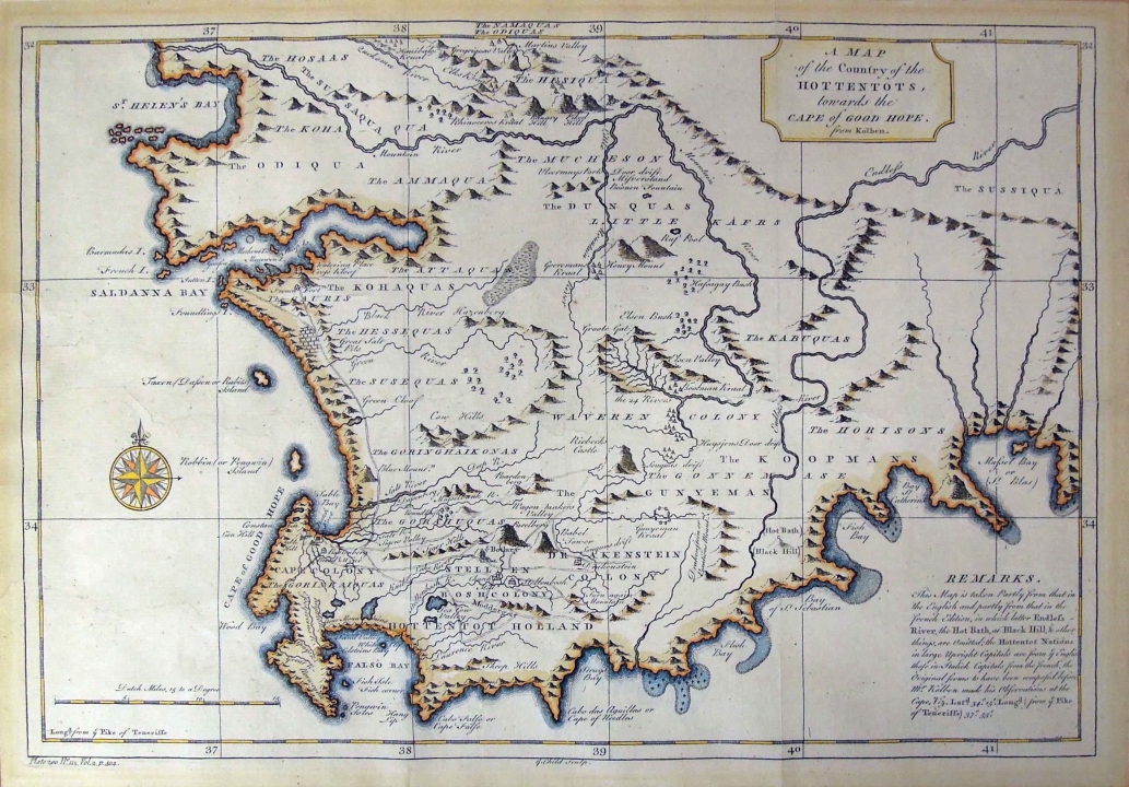
LOT 444
After Kolben, Peter
A MAP OF THE COUNTRY OF THE HOTTENTOTS, TOWARDS THE CAPE OF GOOD HOPE. Netherlands, circa 1750 first edition
Lot Estimate Change Currency
ZAR 1 000 - 1 500
About this Item
After Kolben, Peter
A MAP OF THE COUNTRY OF THE HOTTENTOTS, TOWARDS THE CAPE OF GOOD HOPE. Netherlands, circa 1750 first edition
The hand coloured map depicts Southern Africa from the Cape of Good Hope to The Namaquas and The Odiquas. The map was taken partly from that in the English and partly from that in the French edition, in which latter Endlefs-River, the Hot Bath, at Black Hill & other things are omitted.
Plate 200, No. 115, volume 2, page 404.
24 by 36cm excluding frame; 46 by 57 by 2cm including frame
More from South African and International Fine and Decorative Art
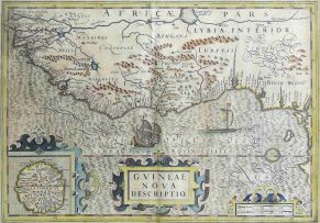
Hondius, Hendrik and Mercator, Gerhard
GVINEAE NOVA DESCRIPTIO. Germany, 1633 first edition
ZAR 2 000 - 3 000
Bertius, P and Tavernier, M
CARTE DE L'AFRIQUE, CORRIGÉE ET AUGMENTÉE DESUS TOUTES LES AUTRES CY DEUANT FAICTES PAR P.BERTIUS. Paris, 1627 first edition
ZAR 3 500 - 5 000
Bowen, Emanuel
A NEW & ACCURATE MAP OF THE SOUTHERN PARTS OF AFRICA, CONTAINING LOWER GUINEA, MONOEMUGI, ZANGUEBAR, AND EMPIRE OF MONOMOTAPA, COUNTY OF THE CAFRES &C. AND THE ISLD. OF MADAGASCAR. London, 1747 first edition
ZAR 2 000 - 3 000
Nicolas Janz Visscher II
CARTE DE L'AFRIQUE MERIDIONALE. Amsterdam, 1730 first edition
ZAR 4 000 - 6 000
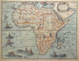
Blaeu, Joan
The hand coloured map bears a large title piece with a cartouche of native huntsmen, monkeys and tortoises. Depicts Southern Africa from the Cape of Good Hope to the Congo on the left and Mozambique on the right. Hand coloured. Sources: Grooten Atlas Volume 8, first edition and Norwich-Stone, Maps of Africa, pages 174/175, map No. 154
ZAR 2 500 - 3 500