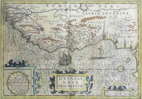
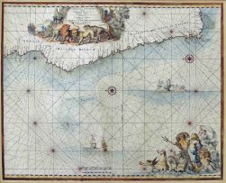
Hondius, Hendrik and Mercator, Gerhard
GVINEAE NOVA DESCRIPTIO. Germany, 1633 first edition
LOT 445
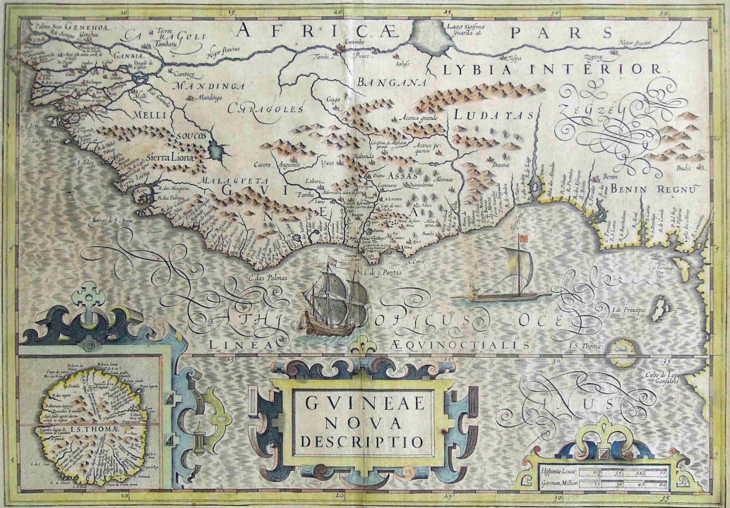
Hondius, Hendrik and Mercator, Gerhard
GVINEAE NOVA DESCRIPTIO. Germany, 1633 first edition
Lot Estimate Change Currency
ZAR 2 000 - 3 000
Selling Price
Incl. Buyer's Premium & VAT
Incl. Buyer's Premium & VAT
ZAR 2 401
About this Item
Hondius, Hendrik and Mercator, Gerhard
GVINEAE NOVA DESCRIPTIO. Germany, 1633 first edition
The hand coloured map depicts West Africa and bears a large title piece in the centre and in the left hand lower corner is an enlarged map titled "L.S. Thoma".
Gerardi Mercatoris Atlas, first edition
Source: Atlas ou Representation; pages 638-639
34,5 by 49cm excluding frame; 52,5 by 63,5 by 2cm including frame
More from South African and International Fine and Decorative Art
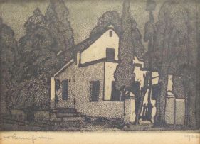
Farmhouse
ZAR 6 000 - 8 000
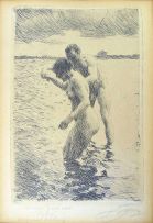
Pilot
ZAR 7 000 - 10 000
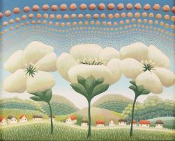
After Ivan Rabuzin
Splendid Flowers, Dietz Replica
ZAR 2 000 - 3 000
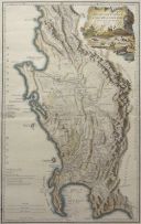
L S De La Rochette
THE DUTCH COLONY OF THE CAPE OF THE CAPE OF GOOD HOPE BY L.S. DE LA ROCHETTE MDCCXCV. London, 1795 first edition
ZAR 2 500 - 3 500
de Wit, Frederick
CIMBEBAS ET CAFFARIAE LITTORA A CATENBELA AND PROMONTORUM BONAE SPEI. Amsterdam, 1680 first edition
ZAR 4 000 - 6 000
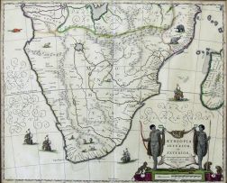
Blaeu, Joan
The hand coloured map bears a large title piece with a cartouche of native huntsmen, monkeys and tortoises. Depicts Southern Africa from the Cape of Good Hope to the Congo on the left and Mozambique on the right. Hand coloured. Sources: Grooten Atlas Volume 8, first edition and Norwich-Stone, Maps of Africa, pages 174/175, map No. 154
ZAR 2 500 - 3 500