Nicolas Janz Visscher II
Carte de L'Afrique Meridionale ou Pays entre La Ligne & Le Cap de Bonne Esperance et L'Isle de Madagascar
LOT 585
Nicolas Janz Visscher II
Carte de L'Afrique Meridionale ou Pays entre La Ligne & Le Cap de Bonne Esperance et L'Isle de Madagascar
Lot Estimate Change Currency
ZAR 4 000 - 6 000
Selling Price
Incl. Buyer's Premium & VAT
Incl. Buyer's Premium & VAT
ZAR 8 783
Auction Catalogue
About this Item
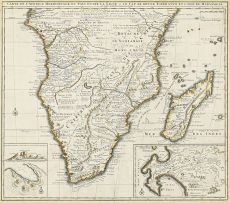
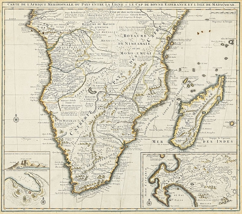
Nicolas Janz Visscher II
Carte de L'Afrique Meridionale ou Pays entre La Ligne & Le Cap de Bonne Esperance et L'Isle de Madagascar
Amsterdam, 1730
first edition
depicts Southern Africa with detailed information about the various settlements including the names of farmers. Bears three insets: "Elevation du port et Mont Table au Cap de Bonne Esperance," "Plan du Port et Mont Table au Cap de Bonne Esperance" and in the right hand lower corner is an enlarged map of the Cape, but without a caption.
51,5 by 58,5cm excluding frame
More from Important South African & International Art, Furniture, Decorative Arts & Jewellery
The White Monday Disaster
ZAR 20 000 - 30 000

Rhino (Head Up)
ZAR 30 000 - 50 000

Man Ray, from Homage to Man Ray
ZAR 30 000 - 50 000
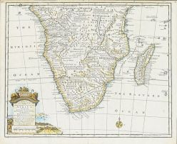
Emanuel Bowen
A New & Accurate Map of the Southern Parts of Africa, containing Lower Guinea, Monoemugi, Zanguebar, the Empire of Monomotapa, Country of the Cafres and the Island of Madagascar
ZAR 2 000 - 3 000
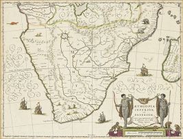
Joan Blaeu
Aethiopia Inferior vel Exterior
ZAR 2 500 - 3 500

Bromphenol Blue
ZAR 60 000 - 80 000